WALL
STRUCTURES

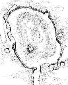
Little is known about the life of the 5000 workers of the gold mine quoted by Plinio, but on the impressive heaps of stones that prove their labour, we still have traces today. All over the upper terrace, mainly east of Vermogno beyond the moraine, there are dry masonries obtained inside the heap of pebbles, mainly square or rectangular, with internal surfaces from 1 to about 100 m2 and between a few decimeters to over 2 m deep, due to settlements (houses, deposits, fireplaces).
|
|
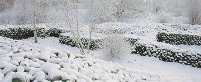
Roman settlements (dry masonries) |
These buildings were generally provided with cover and wainscot, and being far from recent farming areas, they are surely contemporary to the mine exploitation. Their condition is varying: there are areas where the original structures are quite visible (wall ruins) and others where traces are formed by wide depressions in the pebbles, often connected to concentration of oversized pebbles; this suggests that many ruins were filled intentionally when they were abandoned. The shelters set against the erratic blocks, or dug under them did similar use.
 .
. 
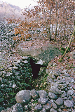
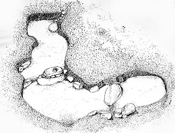
Shelter under rock (Caporale
hamlet)
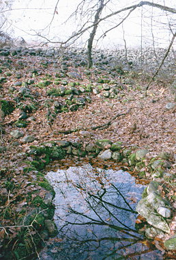
Spring (Caporale
hamlet)
Because of the high number of settlements
(over 250 groups) it is likely that a substantial part of the people connected
to the gold mine settled on the workplace. Excavations made inside the
"settlements" have returned a lot of roman pottery of the Republican
Age (potsherds) and Gallic pottery. A confirmation for dating the mine
exploitation period between the second half of the 2nd century B.C. and the
first half of the 1st century B.C. comes from the find of some coins (the last
one dated 91 B.C.).
Many platform structures, sustained by walls and often
fenced, are near secondary roads. For one of them, a folk customs says that
until the middle of 1800 it was a place where the yearly mass was celebrated.
In the central north part of the Park, below Roletti
and Caporale hamlets in Zubiena, hidden in the heaps and covered with
vegetation, a series of wall structures, completely different from the
previously described "settlements", were built in an unknown period.
In these two areas a thick network of roads and paths, (some still in use today
an d some others abandoned) are near or lead to the entrance of nine buildings,
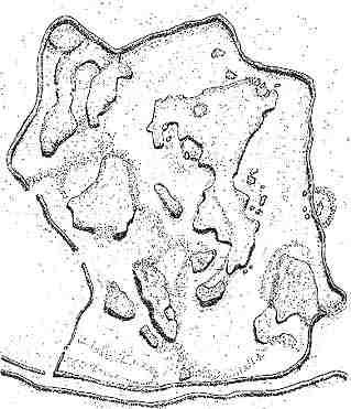
that were used for farming until recent time, at least some of them. They are 5
enclosure structures, three of which with flat surface and two provided with
internal mound partly terraced in Roletti hamlet, while below Caporale hamlet
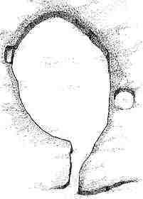
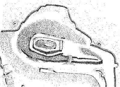
there are other two enigmatic structures with curvilinear passages, a hut with
a table rock and a multiple terrace apparently connected to an engraved rock.
 -
-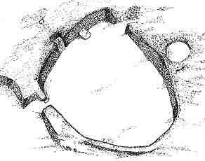 -
- 
Enclosure A: lenght
75 m. -width 65 m. - height 1,20/2,00 m.
Enclosure B: lenght
17 m. -width 13 m. - height 1,10/1,40 m.
Enclosure C: lenght 9
m. -width 6,50 m. - height 0,90/1,20 m.
 ----
---- 
Enclosure D: lenght
35 m. -width 24 m. - height 0,60/0,90 m.
Enclosure E: lenght
65 m.-width 40 m.-height 0,60/1,50 m.
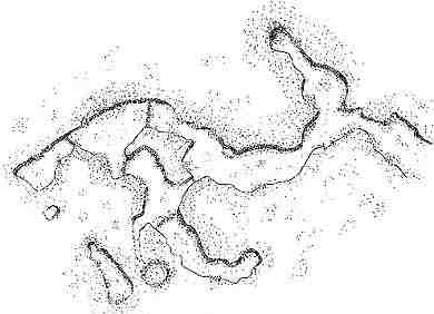
Curvilinear F: lenght
54 m.- width 36 m.- height 0,80/1,80 m.
Curvilinear G: lenght
77 m.-width-64 m -. height 0,50/1,50 m .
 ---
---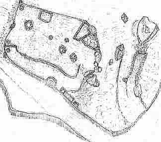
Hut H: lenght 26 m.-
width 4,5 m. - height 1,10/1,60 m.
Multiple terrace I:
lenght 20 m.- width 11 m.- heigth 0,80/1,50 m
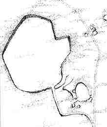
To the typological unicity of these
structures, whose function cannot be explained yet, we have to add that they
are concentrated in two very small areas in the upper Terrace, on a surface of
7.5 hectares in Roletti and 4 hectares in Caporale and they thus represent a
strong anomaly in the homogeneous complex of "buildings" of Bessa.
(schizzi
- P.Argentero, A. Vaudagna - E, F, G from M. & P. Scarzella)